Rakiura Track (Stewart Island)
The Rakiura Track is notionally 3 days of 12km, but the
first two days could be done in one if you have a full day - a taxi
at the beginning saves 5km, and skipping Port William hut another 3.
In good weather in summer, the whole track would be an ok daywalk
for the fit.
We had a brief afternoon tea when we got back from Ulva Island, and we didn't leave Half Moon
Bay to start the Rakiura Track till 4pm. We also did the 5km of road
walking to reach the start of the track -- paying for a shuttle/taxi would
have been the better option, in retrospect, as there was nothing that
memorable along the road. Highlights were the views from Horseshoe Bay,
some Paradise Shelducks, a possum scuttling across the road, and a kereru
(New Zealand pigeon) perched above us.
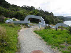
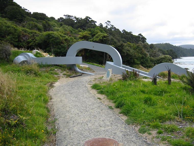
South Island is the canoe; Stewart Island the anchor... |
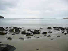
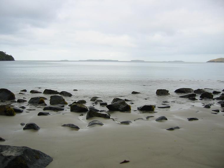
Port William, looking out at the Muttonbird Islands |
Near the start of the track proper is a huge chain "sculpture",
symbolising the Maori explanation of Stewart Island as the anchor to
the canoe of South Island. The track roughly follows the coast, with
a couple of swing bridges to cross rivers, but for much of it there
are no views of the ocean. When we reached the descent to Maori Beach
there was a clear view across Port William to the hut, which we could
make out through binoculars. It was not far as the crow flies, but a
lot further on foot.
The track was mostly gravel, with a few mud patches - and it had been
pretty dry, so my volleys (sandshoes) remained pretty clean. Approaching
the hut there are some sections where there's an easy low-tide track along
the beach, while the high-tide alternative is a muddy climb up and around.
We took one of those by accident.
We didn't reach Port William hut till 8.30. It looked like the bunkrooms
were full, which had us in a momentary panic - Rakiura hut tickets don't
guarantee a sleeping spot - but some kind people made room for us on a long top
that just fitted five. The hut sleeps 30, just, but was pretty much
full; there were three
fishermen were in the kitchen, possibly off the
boat moored offshore.
We had soup and dinner and went
for a short nocturnal insect hunt.
It had been a long day.
We'd packed pretty light - as food we had muesli for breakfast,
ryvita with salami and cheese for lunch, packet pasta for dinner, and
chocolate-coated peanuts for snacks - but we had a couple of extras
with us. Camilla was carrying a Nature Guide to the New Zealand
Forest and I had a heavy tripod, which I had packed in a fit of
insanity and which we referred to as "the brick".
Wednesday 5th February
We slept in and didn't get away until 10.
We backtracked a little to the junction where the Rakiura Track leaves
the coast and crosses the peninsula to North Arm. The alternative is
to keep going around the entire northern end of Stewart Island, which
is the 10 to 12 day Northwest Circuit.
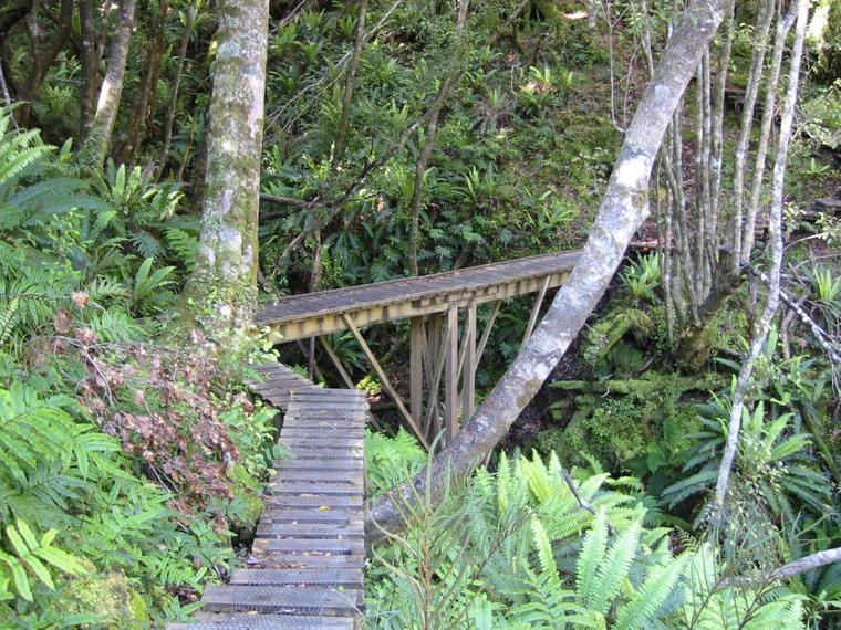
This section of the track is liberally board-walked, with only a few
mud patches. Pretty much the whole day was spent in forest, without
views except at the beginning and end and at a lookout tower at a high
point in the middle. It was a bright, hot day - it was cool under the
forest, but the dappling of sunshine made photography difficult.
We saw and heard quite a few birds - warblers, tui, fantails - but not as
nearly as many as on Ulva. The canopy was mostly Rimu, with some Kamahi
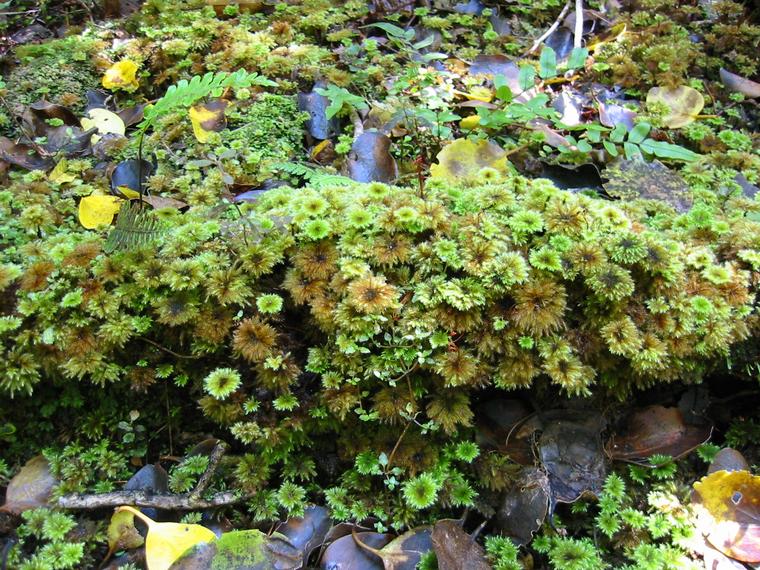
(Weinmannia racemosa) and Southern Rata. Ferns were abundant lower down, with Blechnum
discolor the most common. And there were plenty of epiphytes,
moss, etc.
We arrived at North Arm hut around 6pm and quickly
grabbed sleeping and cooking spots.
We spent some time on the beach, but the
sandflies drove us back into the hut.
After dinner we went for a brief walk up the hill, then sat around reading
by candlelight. I had a mild headache, but Camilla went out again insect
spotting around 9pm - it was still not dark - and we were the last to bed.
Thursday 6th February
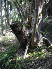
a tree that started as an epiphyte on a fern |
Not wanting to take any risk of missing our 3.30 ferry, we were up at 7.30
and walking by 8.30. At 10 Camilla realised she
hadn't had her caffeine fix, so she had cold coffee. It was windy, with
a bit of cloud, and pleasant under the trees, which made creaking noises.
It was low tide and there were extensive mudflats in some of the bays.
We reached Halfmoon Bay with plenty of time to spare - we got to the DOC
office at 1.30, along with several others who'd been doing the track at
the same time.
We had lunch in a cafe, then sat waiting for the ferry to Bluff at a picnic table on the foreshore.
Some young boys were playing chess on a giant set - I saw a fool's mate,
so there seemed to be some considerable disparity in skills.
It was overcast and breezy, and had started drizzling by the time we went
to the wharf to check in our baggage. A scuba diver with a camera was
swimming near the wharf and three or four blue
penguins - at first we thought they were fish - were feeding not more
than 20m away. It was raining enough to stop me trying to take photos,
but a telephoto lens would have been needed anyway.
Next: Bluff, Invercargill, Te Anau
Previous: Ulva Island (Stewart Island)